Peak Health home > Plants > Grasslands
Why Was This Indicator Chosen?
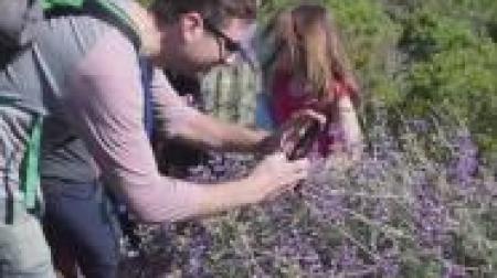
Mt. Tam’s iconic, sweeping grasslands serve as habitat for numerous plants and animals, and contain tremendous biodiversity. Grassland ecosystems are dominated by both perennial and annual herbaceous plants, with little to no trees or shrubs. Dominant native grassland species in the One Tam area of focus include purple needlegrass (Stipa pulchra), blue wild rye (Elymus glaucus), clovers (Trifolium spp.), California oatgrass (Danthonia californica), and red and blue fescue (Festuca rubra and F. idahoensis), among others.
California's native grasslands are among the most endangered ecosystems in the country, at 1% of their historical extent, and Mt. Tam preserves some of the best examples of remnant grassland ecosystems in the region (Noss & Peters, 1995). Perennial grasslands provide ample carbon storage below ground in extensive root systems (Potthoff et. al., 2005) and some species of native grasses can live for hundreds of years (Marty et al., 2005).
Nearly 90 percent of California’s rare plant species listed in the Inventory of Rare and Endangered Species in California (Skinner & Pavlik, 1994) may be found within California grasslands, in addition to 30 percent of the threatened and endangered wildlife species (over 40 percent of terrestrial animals) (CDFW, 2016). American badgers (Lay, 2008) and grassland-nesting birds (Rao et al., 2008) rely on large patches of grassland for reproduction and forage.
What is Healthy?
The desired condition for grasslands is the persistence of large (30 acres or above), intact, native-rich blocks of this vegetation type, which supports grassland-dependent plant and wildlife species sensitive to edge effects and fragmentation. Good examples can be found on Pine Mountain, in scattered patches along Highway 1, and adjacent to Bootjack Creek below Mountain Theater.
What Are the Biggest Threats?
- At nearly all grassland sites, non-native species make up the majority of the plant cover, which has caused a loss of native species diversity, changes in nutrient cycling and hydrology, and shifts in invertebrate abundances (MMWD, internal data; CNPS, 2006; Steers, 2013; Ford & Hayes, 2007)
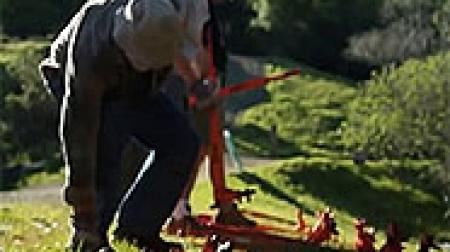
- Transition to scrublands, woodlands, and/or forest in the absence of fire, grazing, or other landscape-scale disturbance
- The potential effects of climate change, including frequent drought conditions and increased climatic water deficit under warmer temperatures
- Lack of episodic disturbances from fire and from grazing by antelope, tule elk, and black-tailed deer, which has resulted in the loss of native species productivity, diversity, and the loss of grasslands themselves as they convert to woody dominated communities
- Atmospheric nitrogen deposition, which can cause increased annual grass biomass, an accumulation of thatch, and losses of native biodiversity (Molinari & D’Antonio, 2014)
- Non-system (unofficial) trails contribute to erosion, localized soil compaction, and invasive plant spread
What is The Current Condition?
The overall condition of Mt. Tam’s grasslands is Fair. An overall decline in mapped grasslands was detected at a rate of 30% between the data sources used for the 2016 grasslands chapter and the 2018 Fine Scale Vegetation Map. Some of this change occurred after of the 1994 mapping, some is attributable to new mapping rules, and some may be attributable to grassland succession to woody types. Eleven patches of grassland at 30 acres or more in size were observed in 2022, down from 19 in 2016. This chapter establishes a new baseline for future comparisons. If vegetation mapping rules continue to evolve, comparisons may be made through separate analyses using aerial imagery (Startin, 2022). In addition, we have only limited data about the composition of native species present in Mt. Tam's grasslands.
What is the Current Trend?
The trend is unknown as of our 2022 update. The 2018 Marin County Fine Scale Vegetation Map provided new information on grassland extent and composition to support this chapter update. Notably, it documented significantly fewer acres of grassland than were included on earlier maps. A change in geographic boundaries for the One Tam area of focus also changed grassland extent. Differences in this map and previous efforts meant that we had to establish a new baseline from which a trend may be inferred in the future.
How Sure Are We?
We have Low confidence in this assessment because available data sources between 2016 and 2022 are not comparable, which prevents a full assessment of metrics. In addition, we have only limited data about the composition of native species present in Mt. Tam's grasslands.
What is This Assessment Based On?
- Marin Water vegetation maps (2004, 2009, 2014; AIS, 2015)
- Marin County Parks vegetation map (2008; AIS, 2008)
- National Park Service vegetation map and study (2013)
- Redwood Creek grassland assessments (2017)
- One Tam grassland assessments (2018)
- Marin Countywide Fine Scale Vegetation Map (2018; GGNPC et al., 2021)
What Don’t We Know?
Key information gaps include:
- Change-over-time assessment of total acres of grasslands and patch size
- Comprehensive grassland composition data from a permanent plot network spanning all agency jurisdictions that would reveal changes is grassland species over time
resources
Aerial Information Systems [AIS]. (2008). Marin County Open Space District vegetation photo interpretation and mapping classification report. Prepared for Marin County Parks.
Aerial Information Systems [AIS]. (2015). Summary report for the 2014 photo interpretation and floristic reclassification of Mt. Tamalpais watershed forest and woodlands project. Prepared for Marin Municipal Water District.
Bay Area Open Space Council [BAOSC]. (2011). The conservation lands network: San Francisco Bay Area upland habitat goals project report. https://tinyurl.com/4kewd2w3
California Native Plant Society [CNPS]. (2016). A manual of California vegetation [Online].
California Department of Fish and Wildlife [CDFW]. (2016). California natural diversity database. State and federally listed endangered and threatened animals of California.
D’Antonio, C., Bainbridge, S., Kennedy, C., Bartolome, J., & Reynolds, S. (2002). Ecology and restoration of California grasslands with special emphasis on the influence of fire and grazing on native grassland species. Prepared for the Packard Foundation. https://ucanr.edu/sites/BayAreaRangeland/files/257975.pdf
Evens, J., Kentner, E., & Klein, J. (2006). Classification of vegetation associations from the Mount Tamalpais watershed, Nicasio reservoir, and Soulajule reservoir in Marin County, California [Technical report]. Prepared for Marin Municipal Water District. https://www.researchgate.net/publication/328432434
Fenn, M. E., Allen, E. B., Weiss, S. B., Jovan, S., Geiser, L. H., Tonnesen, G. S., Johnson, R. F., Rao, L. E., Gimeno, B. S., Yuan, F., Meixner, T., & Bytnerowicz, A. (2010). Nitrogen critical loads and management alternatives for N-impacted ecosystems in California. Journal of Environmental Management, 91(12), 2404–2423. https://doi.org/10.1016/j.jenvman.2010.07.034
Ford, L. D., & Hayes, G. F. (2007). Northern coastal scrub and coastal prairie. In M. Barbour, T. Keeler-Wolf, & A. A. Schoenherr (Eds.), Terrestrial vegetation of California (3rd ed.; pp. 180–207). University of California Press.
Golden Gate National Parks Conservancy [GGNPC], Tukman Geospatial, & Aerial Information Systems. (2021). 2018 Marin County fine scale vegetation map datasheet. Tamalpais Lands Collaborative (One Tam). https://tukmangeospatial.egnyte.com/dl/uQhGjac1zw
Keeler-Wolf, T., van der Leeden, P., Schirokauer, D. (2003). Field key to the plant communities: Point Reyes National Seashore, Golden Gate National Recreation Area, San Francisco Water Department Watershed Lands, Mount Tamalpais, Tomales Bay, and Samuel P. Taylor State Parks. National Park Service. https://irma.nps.gov/DataStore/DownloadFile/599108
Kraft, K., Luke, C., Olyarnic, S., Jeffery, D., Solomeshch, A., & Koltunov, A. (2014). Coastal prairie enhancement and feasibility study (Final report).
Lay, C. (2008). The status of the American badger in the San Francisco Bay Area [Unpublished master’s thesis (3623)]. San Jose State University. https://doi.org/10.31979/etd.rwey-j4ms
Marty, J. T., Collinge, S. K., & Rice, K. J. (2005). Responses of a remnant California native bunchgrass population to grazing, burning and climatic variation. Plant Ecology, 181, 101–112. https://doi.org/10.1007/s11258-005-3797-z
Molinari, N. A., & D’Antonio, C. M. (2014). Structural, compositional and trait differences between native- and non-native-dominated grassland patches. Functional Ecology, 28(3), 745–754. https://doi.org/10.1111/1365-2435.12206
Noss, R. F., & Peters, R. L. (1995). Endangered ecosystems: A status report on America’s vanishing habitat and wildlife. Defenders of Wildlife. https://tinyurl.com/y6mz6jmm
Potthoff, M., Jackson, L. E., Steenwerth, K. L., Ramirez, I., Stromberg, M. R., & Rolston, D. E. (2005). Soil biological and chemical properties in restored perennial grassland in California. Restoration Ecology, 13(1), 61–67. https://doi.org/10.1111/j.1526-100X.2005.00008.x
Rao, D., Gennet, S., Hammond, M., Hopkinson, P., & Bartolome, J. (2008). A landscape analysis of grassland birds in a valley grassland-oak woodland mosaic (USDA General Technical Report PSW-GTR-217). U.S. Forest Service.
Schoenherr, A. A. (1992). A natural history of California. University of California Press.
Skinner, M. W., & Pavlik, B. M. (1994). Inventory of rare and endangered vascular plants of California (5th ed.). California Native Plant Society.
Startin, C. R. (2022). Assessing woody plant encroachment in Marin County, California, 1952–2018 [Unpublished master’s thesis]. University of Southern California. https://tinyurl.com/yck77dt7
Steers, R. J., & Spalding, H. L. (2013). Native component grasslands of the Marin Headlands (Natural Resource Technical Report NPS/SFAN/NRTR—2013/832). National Park Service. https://irma.nps.gov/DataStore/DownloadFile/487215
Thorne, J. H., Boynton, R. M., Holguin, A. J., Stewart, J. A., & Bjorkman, J. (2016). A climate change vulnerability assessment of California’s terrestrial vegetation. California Department of Fish and Wildlife.
Thorne, J. H., Choe, H., Boynton, R. M., Bjorkman, J., Albright, W., Flint, A. L., Flint, L. E., & Schwartz, M.W. (2017). The impact of climate uncertainty on California’s vegetation and adaptation management. Ecosphere, 8(12), e02021. https://doi.org/10.1002/ecs2.2021
Weiss, S. B. (2006). Impacts of nitrogen deposition on California ecosystems and biodiversity (Publication No. CEC-500-2005-165). California Energy Commission. https://tinyurl.com/yttj8tef
Zhu, K., Chiariello, N. R., Tobeck, T., Fukami, T., & Field, C. B. (2016). Nonlinear, interacting responses to climate limit grassland production under global change. Proceedings of the National Academy of Sciences