Peak Health home > Landscapes > Ecological Processes & Stressors > Climate Change
Climate Change on Mt. Tam
Mt. Tam has the potential to serve as a refuge for plant and animal species in the face of climate change, and associated changes in temperature, precipitation, fog, and soil moisture. Although climate change models show a range of potential future scenarios for Marin County and the San Francisco Bay Area, some common trends have emerged. Because there is greater uncertainty in projecting precipitation than there is for temperature, we summarize results for two climate change models with comparable temperature increases but different rainfall projections: Warm/Wet and Warm/Dry.
Temperature
Average temperatures rose significantly from 1950 to 2000 across the entire western United States, including the San Francisco Bay Area, and both winter and summer temperatures are predicted to continue rising under future climate change scenarios. Temperature projections spanning potential Warm/Wet and Warm/Dry conditions under the business-as-usual emissions scenario (referred to as RCP 8.5 in the report and used throughout the 2022 Peak Health assessment), show potential increases in annual temperatures for the One Tam focus area ranging from approximately 3.4°F (1.9°C) by mid-century to 6.0°F (3.4°C) by the end of the century (Pierce et al., 2018).
Precipitation
Future precipitation patterns predictions for Mt. Tam are more uncertain, with projected annual precipitation change ranges from approximately 9% less to 20% more by mid-century, and 2% to 30% more by the end of the century. In addition to changes in the overall amount of precipitation, rainfall variability and the frequency of extreme events are expected to increase (Pierce et al., 2018). This may cause flooding and more frequent and intense droughts, which may affect the condition of Mt. Tam's streams and wetlands. Models also suggest that the timing of rainfall may shift to a narrower winter window, with the potential for earlier onset of warmer and drier spring conditions (Micheli et al., 2016).
Fog
Fog is an important source of moisture on the mountain, particularly during the spring and summer. The sole dynamic simulation model for coastal fog in California shows a potential long-term trend of a 12% to 20% reduction from 1900 to 2070, with significant uncertainty (Ackerly et al., 2018; O’Brien et al., 2013). An earlier study found that the amount of fog in redwood forests along California's coast has fallen 33% over the past 100 years (Johnstone & Dawson, 2010). Fog-dependent plant communities on Mt. Tam such as redwood forests and maritime chaparral may become drought-stressed under conditions of less fog and higher temperatures.
Soil Moisture
Rising temperatures are making Marin County more arid. Even under higher future rainfall scenarios, hotter temperatures will increase evapotranspiration and essentially reduce available soil moisture. This difference between potential and actual evapotranspiration—known as climatic water deficit—is a good indicator of drought stress (Flint et al., 2013). Potential increased climatic water deficits are on the order of 3 inches of equivalent rainfall for the One Tam focus area by mid-century (Micheli et al., 2016).
Wildfire Hazards
Between 2000 and 2020, approximately 127 acres of the area of focus burned (CalFire, 2020). While many of Mt. Tam’s ecosystems are fire-adapted, successful fire suppression policies have led to a significant accumulation of fuels (vegetation capable of feeding a wildfire). Warmer, drier conditions combined with fuel accumulation are increasing the chances of wildfire in Marin County. California’s Fourth Climate Change Assessment projects that Mt. Tam will have an end-of-century wildfire probability increase of approximately 10% compared to historical conditions (Westerling, 2018); alternative methods suggest an increase on the order of 15% over 30 years consequent to the combined effect of projected climate change and land use (Krawchuk & Moritz, 2011; Mann et al., 2016). “Fire weather,” a condition characterized by low humidity and high wind, may also become more frequent over time. Significant fire-mitigation efforts, with a focus on fuels reduction, are underway, with the potential for direct and indirect impacts on watershed function and biodiversity. Resumption of controlled fire, where feasible, may be considered part of a climate-adaptation strategy.
Sea Level Rise and Coastal Erosion
Based on a business-as-usual emissions scenario, a recently published sea-level rise model (Griggs & Reguero, 2021) estimates that the average (or 50th percentile) will range from 13 cm in 2030 to 75 cm by 2100. Changes in sea level have potentially significant impacts on coastal areas as well as estuarine and freshwater systems farther inland in the area of focus. When combined with periodic El Niño events driven by seasonally elevated water levels, sea level rise is estimated to create up to 30% larger winter wave energy, a key driver of coastal vulnerability in coming decades (Barnard et al., 2015).
Plant and Animal Community Change
Changes in temperature, precipitation, fog, and soil moisture may make future conditions inhospitable for certain plant species, or even entire communities. The term “climate exposure” can be used to describe the estimated combined impact of climate stressors on local vegetation (Thorne et al., 2017). Both the Warm/Wet and Warm/Dry models project that Mt. Tam’s higher-elevation areas will experience lower climate exposure and its western portion will undergo higher climate exposure by the end of the century. In the long term, climate change is expected to alter the basic physical conditions under which native plant communities on Mt. Tam have evolved, with climate exposure forcing a shift in both composition and distribution. These shifts may be facilitated by short-term (episodic) disturbances such as fires, droughts, floods, and pest outbreaks, all of which are becoming more frequent. Vegetation’s sensitivity to climate change is heterogeneous and complex, but models for Marin County suggest an expansion of climate conditions suitable for more drought-tolerant species and communities, including coastal sage scrub and chamise chaparral, as climatic water deficit increases (Ackerly et al., 2012; Micheli et al., 2016; Thorne et al., 2017).
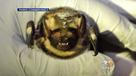
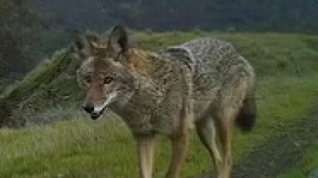
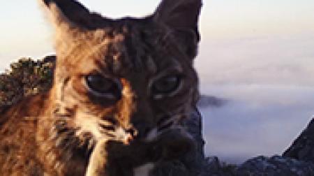
The effects of climate change on animals are similarly varied and challenging to predict, and few studies have focused on how it will affect Bay Area’s wildlife (Ackerly et al., 2018). However, changes in vegetation communities, which will undoubtedly have consequences for the wildlife that depends upon them, may ripple up and down trophic levels. One Tam’s long-term Marin Wildlife Watch camera-monitoring project is expected to be a valuable resource as we work to understand variations in wildlife occupancy (a metric of presence) over time. It is anticipated that wildlife that requires cool, wet conditions may be at greatest risk. Warmer temperatures may also change movement patterns, and rising sea levels will likely affect coastal, bay, and lower floodplain habitats in the area of focus. Changing ocean conditions may also impact species such as the endangered coho salmon (Oncorhynchus kisutch) and the threatened steelhead trout (O. mykiss), which spend part of their lives in Mt. Tam’s streams and part at sea. Known or predicted effects of climate change of concern for specific plant and wildlife species or communities are described for each indicator in this assessment.
resources
Ackerly, D. D., Ryals, R. A., Cornwell, W. K., Loarie, S. R., Veloz, S., Higgason, K. D., Silver, W. L., & Dawson, T. E. (2012). Potential Impacts of Climate Change on Biodiversity and Ecosystem Services in the San Francisco Bay Area. California Energy Commission. Publication number: CEC-500-2012-037.
Ackerly, D., Jones, A., Stacey, M., & Riordan, B. (2018). San Francisco Bay Area summary report: California’s fourth climate change assessment (Publication no. CCCA4-SUM-2018-005). California Energy Commission. https://www.energy.ca.gov/sites/default/files/2019-11/Reg_Report-SUM-CCCA4-2018-005_SanFranciscoBayArea_ADA.pdf
Barnard, P. L., Short, A. D., Harley, M. D., Splinter, K. D., Vitousek, S., Turner, I. L., Allan, J., Banno, M., Bryan, K. R., Doria, A., Hansen, J. E., Kato, S., Kuriyama, Y., Randall-Goodwin, E., Ruggiero, P., Walker, I. J., & Heathfield, D. K. (2015). Coastal vulnerability across the Pacific dominated by El Niño/Southern Oscillation. Nature Geoscience, 8, 801–807. https://doi.org/10.1038/ngeo2539
CalFire. (2020). Wildfire perimeters and prescribed burns 2020. California Department of Forestry and Fire Protection [Data set]. Retrieved June 2022 from California State Geoportal. https://gis.data.ca.gov/datasets/CALFIRE-Forestry::california-wildland-fire-perimeters-all
Griggs, G., & Reguero, B. G. (2021). Coastal adaptation to climate change and sea-level rise. Water, 13(16), 2151. https://doi.org/10.3390/w13162151
Johnstone, J. A. & Dawson, T. E. (2010). Climatic context and ecological implications of summer fog decline in the coast redwood region. Proceedings of the National Academy of Sciences USA, 107 (10), 4533-4538. Available at: http://www.pnas.org/content/107/10/4533.short
Krawchuk, M. A., & Moritz, M. A. (2011). Constraints on global fire activity vary across a resource gradient. Ecology, 92(1), 121–132. https://doi.org/10.1890/09-1843.1
Mann, M. L., Batlori, E. B., Moritz, M. A., Waller, E. K., Berck, P., Flint, A. L., Flint, L. E., & Dolfi, E. (2016). Incorporating anthropogenic influences into fire probability models: Effects of human activity and climate change on fire activity in California. PLoS ONE, 11(4), e0153589. https://doi.org/10.1371/journal.pone.0153589
Micheli, E., Flint, L., Veloz, S., Johnson (Higgason), K., & Heller, N. (2016). Climate Ready North Bay Vulnerability Assessment Data Products: 2. Marin Municipal Water District User Group. A technical memorandum prepared by the Dwight Center for Conservation Science at Pepperwood, Santa Rosa, CA, for the California Coastal Conservancy and Regional Climate Protection Authority. Available from http://climate.calcommons.org/crnb/mmwd
O’Brien, T. A., Sloan, L. C., Chuang, P. Y., Faloona, I. C., and Johnstone, J. A. (2013). Multidecadal simulation of coastal fog with a regional climate model. Climate Dynamics, 40(11–12), 2801–2812. https://doi.org/10.1007/s00382-012-1486-x
Pierce, D. W., Kalansky, J. F., & Cayan, D. R. (2018). Climate, drought, and sea level rise scenarios for California’s fourth climate change assessment (Publication no. CNRA-CEC-2018-006). California Energy Commission. https://tinyurl.com/4hu6r6uh
Thorne, J. H., Choe, H., Boynton, R. M., Bjorkman, J., Albright, W., Nydick, K., Flint, A. L., Flint, L. E., & Schwartz, M. W. (2017). The impact of climate uncertainty on California’s vegetation and adaptation management. Ecosphere, 8(12), e02021. https://doi.org/10.1002/ecs2.2021
Westerling, A. L. (2018). Wildfire simulations for California’s fourth climate change assessment: Projecting changes in extreme wildfire events with a warming climate (Publication no. CCCA4-CEC-2018-014). California Energy Commission. https://tinyurl.com/mrx9bbkw