Information Gaps
Overview
In addition to helping share what is known about the health of Mt. Tam, this assessment process revealed critical data gaps for a number of important health indicators. Since the first assessment in 2016, One Tam partners have been working to fill some of these gaps where possible, and new information needs were identified in the second assessment in 2022-23. Updates on how we're filling these gaps are also provided below where available. Click links below to jump to a particular topic (and click the back button on your browser to return to this list).
- Insects
- California Giant Salamander
- Bats
- Tree Squirrels
- Small Mammals
- Migratory Species
- Vegetation Management & Monitoring
- Mountain-wide Floristic Diversity
- Seeps, Springs & Wet Meadows
- Riparian Forests & Woodlands
- Hardwood Forests & Woodlands
- Douglas-fir Forests
- Lichens
- Soils
- Hydrologic Functions
You can also visit the report chapters on information gaps in the 2023 report for vegetation and for wildlife for greater detail.
Insects
Due to their unparalleled diversity, small size, important ecological function, and often cryptic habits, there are few complete insect surveys for most ecosystems, including those found on Mt. Tam. Outside of some work on butterflies and bees (see below for an update about bees), the mountain’s invertebrates have not been well studied.
Reviewing and consolidating species records from existing collections will be a crucial step in developing invertebrate monitoring programs. Teaming up with local entomologists will help set the focus for these inventories, address data gaps, and interpret the results in the context of larger-scale patterns of richness and population fluctuations.
All-taxa “bioblitzes” involving experts and interested community members could also produce valuable information on the insect fauna of selected habitats over a number of years. Taxa-specific inventories might include dragonflies and damselflies (Odonata), ground beetles (Carabidae), butterflies and moths (Lepidoptera), ants (Formicidae), and bees (Apoidea).
The use of iNaturalist as a tool for community science and crowd-sourced data has grown tremendously since the first iteration of this report in 2016. However, the availability of expert taxonomic knowledge and challenges in making species-level identifications for insects (which, in some cases, cannot be done from a photograph) continues to limit the utility of iNaturalist for insects.
Update: Currently, One Tam partners are undertaking efforts to learn more about native bees and monarch butterfly in the region:
- Monarch butterfly has been declining throughout its range, was listed in 2014 as a candidate species under the Federal Endangered Species Act. The western monarch is in serious decline, with overwintering populations falling by more than 99% since the mid-1980s. Patches of narrowleaf milkweed, the native host plant for monarch butterfly in Marin County, can be found on Marin Water and Marin County Parks lands. While each of the following activities is already underway to some extent, the need to support and expand them, and then to collect and analyze the accumulated data, continues: Community science–led monarch counts at Marin County overwintering groves led by Xerxes Society, or any time via iNaturalist, habitat enhancement, and migration studies.
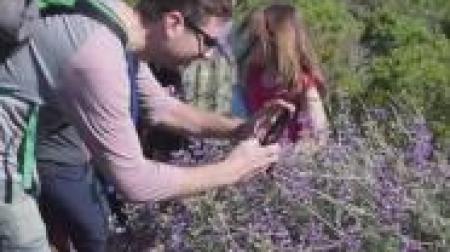
- In response to interest and need to learn more about pollinators, in 2017 One Tam launched the Tamalpais Bee Lab community science program as a volunteer-powered inventory of the region's wild bees. See what they're finding and learn more about current programming.
California Giant Salamander (Dicamptodon ensatus)
Although not federally listed, this species is a Special Status animal and has a state Natureserve rank of S2/S3 (imperiled/vulnerable) and an ICUN status of near threatened. They are excellent indicators of stream health due to their relatively long lives and stable population sizes.
California giant salamanders live in some of Mt. Tam’s streams; however, our current knowledge of giant salamanders is limited to a larval inventory of the species in Redwood Creek in Muir Woods and Mount Tamalpais State Park, limited stream surveys by USGS in the region on federal lands, and incidental observations during fish surveys.
The primary goal of California giant salamander monitoring would be to establish a baseline of presence/not found status for all of the headwater streams in the One Tam area of focus. California giant salamanders are easily distinguished from other salamanders and newts, and would also be suitable for a community science inventory and monitoring program.
Update: One Tam launched an ongoing, crowd-sourced, community science approach to learning more about this species' presence in the region, utilizing iNaturalist. Learn more and participate.
Bats
Mt. Tam supports a diverse bat community that provides important ecosystem services such as insect control. Bats are good ecological indicators because they are sensitive to climate change, habitat loss, pesticides, disease, and disturbance at breeding colonies.
Our current knowledge of bats on Mt. Tam is limited to inventory studies of bats at Muir Woods and MMWD structures, as well as very limited monitoring and research. Completion of a comprehensive bat inventory is a necessary first step in developing a monitoring program that can inform meaningful protection for at least 12–14 bat species believed to occur on Mt. Tam.
The primary goal of bat monitoring would be to establish a baseline of bat species diversity in priority habitats (e.g., redwood and Douglas-fir forest, oak woodlands, riparian areas, and lakes). Also, identifying locations of key maternity colonies would allow these sites to be monitored, protected, and investigated for white-nose syndrome.
Update: One Tam launched a bat monitoring program in 2018. See what they're learning and learn about the effort.
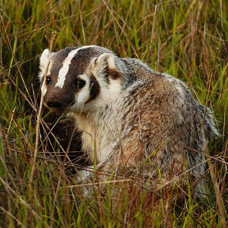
Tree Squirrels
The invasive eastern gray squirrel (Sciurus carolinensis) is spreading beyond urban areas in the Bay Area where it was first introduced. Some areas report declines in western gray squirrels in areas with eastern gray squirrels (Johnston, 2013). The invasive eastern fox squirrel (Sciurus niger) is also in Marin, and some southern California studies show that it is negatively affecting western gray squirrels there (Cooper & Muchlinski, 2015).
Western gray squirrels are vital to Mt. Tam’s biodiversity, serving as both seed predators and dispersers and ranking among the most commonly detected species by our Marin Wildlife Watch program. The goals of this work would be to document the extent and density of western, eastern gray, and fox squirrels and the degree to which their ranges overlap. We would also examine whether these invasive squirrels are excluding native western gray squirrels. In addition, we would be interested in using genetics to help confirm species identifications and, ideally, to establish criteria to distinguish them reliably in wildlife camera images.
Small Mammals
Small mammals are sensitive to habitat change, are an important food resource for predatory species, and can impact vegetation by consuming and dispersing seeds.
Mt. Tam supports a diverse small mammal community, but they have not been well studied. Inventories of the Golden Gate National Recreation Area (Semenoff-Irving & Howell, 2005), Muir Woods National Monument (Howell et al. 1998), and Point Reyes National Seashore (Fellers & Pratt, 2002) have been completed, but not updated. Additional work on Mt. Tam includes an inventory of small mammals at Muir Beach (Takekawa et al., 2003) and Sudden Oak Death research on deer mice and woodrats (Swei et al., 2011). The Marin Wildlife Watch is providing information on the terrestrial mammal community larger than 1 kg., and more information on the state of small mammals on Mt. Tam would complement that project.
Goals of small mammal monitoring would be to inventory small mammals in priority habitat types, including updating previous monitoring work. Particular attention would be paid to cataloging the species that are currently present, in order to identify whether species are disappearing from, or moving in to, the Mt. Tam area. Particular attention should be paid to habitat types that are rapidly changing.
Migratory Species
Mt. Tam provides habitat for an amazing diversity of both resident and migratory wildlife species. For example, its location along the Pacific Flyway means that we have both fall and spring migrating birds in addition to those that live here year-round.
Migratory species pose special management challenges, as they rely on a range of landscapes that fall under many land-ownership jurisdictions and have various levels of protection. In some cases, they are also dependent on the connectivity of these lands, decisions about which are made by many people or even by many countries. These migratory patterns, which have evolved over thousands of years, are essential to supporting the mountain’s biodiversity and need to be protected. Acquiring more data on migratory species’ seasonality and movement patterns will help us do this.
Studying migratory animals as they travel across sometimes great distances can be difficult. However, if tagged with a tracking device, species such as birds, bats, and even monarch butterfly (Danaus plexippus plexippus) can be detected as they pass by towers connected to the Motus Wildlife Tracking System network. Our One Tam studies will benefit from data from outside Marin County, and data from our towers will benefit studies in other areas. Candidate species include hoary bat, monarch butterfly, and raptors, which are all currently part of One Tam programs.
Vegetation Management & Monitoring
One Tam partner agencies manage their own vegetation programs as well as benefit from larger-scale efforts supported by the partnership. These include the mountain-wide early detection and rapid response program for invasive weeds and the 2018 Marin Countywide Fine Scale Vegetation Map (GGNPC, 2021). Several information gaps apply to multiple health indicators:
- Complete an Historical Conditions Analysis for Priority Taxa: Many of the condition statements made about the mountain’s health indicators are based on comparisons to historical ranges or population statuses. While for some species, especially rare ones, historical information is available electronically and has been incorporated, not all museum collection information has been gathered or can be readily accessed. Partnering with natural history museums will allow us to compare the past to the present and paint a more complete picture.
- Institute Systematic Plant Community Monitoring: All One Tam agencies should apply the National Park Service’s San Francisco Bay Area Network Inventory & Monitoring (SFAN I&M) approach to tracking long-term changes in a suite of vegetation communities. This approach uses a network of strategically placed plots to monitor fine-scale floristic change over time in specific communities. Currently included are coastal prairies at Point Reyes National Seashore, redwood forests at Muir Woods National Monument, mixed chaparral at Pinnacles National Park, and coastal scrub at Golden Gate National Recreation Area. Establishing similar plots elsewhere within the One Tam area of focus and training other agencies’ staff in similar protocols will allow us to pool and compare data across jurisdictions. Including additional vegetation types will improve our understanding of how the region’s biodiversity is responding to various stressors and further inform how to better protect the health of the mountain’s exceptional plant diversity.
- Develop a Mt. Tam Climate Adaptation Strategy to Further Inform Vegetation Management: The San Francisco Bay Area’s climate is changing in ways that will likely impact spatial patterns or distributions of native plant communities. Several recent studies and predictive modeling efforts (Thorne et. al., 2016; Ackerly et. al., 2012) provide insights into the climate vulnerability of existing vegetation communities and the possible future distribution of dominant plant species under various climate futures. Exploring the connections between these models and their projections for Mt. Tam’s vegetation is a vital step in crafting adaptive strategies that will sustain vibrant, diverse ecosystems into the future.
Mountain-wide Floristic Diversity
A mountain-wide measure of floristic diversity derived from iNaturalist observations would allow us to track change over time and inoculate ourselves against Shifting Baseline Syndrome (Pauly, 1995). This phenomenon occurs when, based on limited experience and memory, our collective concept of “normal” shifts so gradually that changes go unnoticed. Using crowdsourced community science data from iNaturalist could establish a mountain-wide floristic diversity indicator in a meaningful and repeatable way that also promotes public participation and stewardship. Using iNaturalist data to assess mountain-wide floristic diversity has tremendous potential that needs additional investment to be fully realized, including to ensure data quality and refine analytical methods. In addition, building community scientist capacity by offering more training opportunities can improve the experience of observers and the quality of their data.
Seeps, Springs & Wet Meadows
Seeps, springs, and wet meadows are characterized by fresh groundwater discharge that rises to form distinctive wetland features. These areas support (often unique) ecosystems (Howard & Merrifield, 2010) and certain rare plants. These nutrient-rich environments provide vital food and habitat for many insects, amphibians, reptiles, birds, and mammals, and can be used as indicators of biological integrity and diversity, natural processes, climate change vulnerability, natural disturbance regime, and habitat quality.
Our current knowledge of the locations, discharge rates and size of wetland features is limited to few inventory studies (to primarily on NPS lands) and very limited monitoring. Developing a mountain-wide survey protocol and associated monitoring program that helps us understand hydrology and species composition will improve our understanding of how these landscape features are changing in response to climate change and other stressors.
The proposed Potrero Meadow One Tam Pilot Project would re-align existing trails so that they circumnavigate the diverse wetland habitat. It would also identify and implement a strategy to control and remove invasive non-native perennial grasses and stimulate revegetation with wetland species, allowing for habitat revitalization.
Update: One Tam partners did a springs inventory in 2016, which established a baseline dataset and a map of spring locations in Mt. Tamalpais State Park and the Marin Water watershed. The study recorded disturbance sources, site conditions, flow duration and distance, substrate characteristics, vegetation cover, and dominant species (Kurzweil et al., 2021). While this study provided important baseline data, we have not yet been able to translate it into a mountain-wide survey protocol and associated monitoring program that would help us understand flow and species composition nor how these landscape features are responding to climate change and other stressors.
Riparian Forests & Woodlands
Riparian areas comprise less than 1% of the land in the western United States (Natural Resources Conservation Service, 1996); however, native riparian plant communities make up some of the most productive wildlife habitats in North America. They are critically important to the life cycle of endangered salmonid species (Federal Interagency Stream Restoration Working Group, 1998), and the linear nature of riparian ecosystems provides distinct corridors that are important as migration and dispersal routes. These systems are also responsible for the regulation of critical ecosystem functions such as nutrient cycling, energy transfer, and water purification in adjacent aquatic environments.
Mt Tam’s riparian forest and woodland species are being impacted by many stressors including groundwater depletion, climate change, and non-native invasive species. It would be important to monitor the changes and impacts to these ecosystems as they react and respond to these stressors.
Our current knowledge of both the integrity and connectivity of Mt Tam’s riparian habitats is limited to past monitoring efforts focused on specific restoration projects or weed detection surveys. Developing a mountain-wide assessment and associated monitoring program will improve our understanding of the health of these communities, and how these landscape features are changing in response to climate change and other stressors.
Update: The 2018 Marin Countywide Fine Scale Vegetation Map (GGNPC et al., 2021) provides some insight into the composition and distribution of riparian woodlands and forests, but more analysis is needed to fully establish baseline conditions.
Hardwood Forests & Woodlands
Hardwood forests and woodlands are the most extensive set of tree-dominated vegetation types within the One Tam area of focus, covering 7,110 acres or 20% of the One Tam open space. Therefore, the extent, integrity, and health of these communities would be an important indicator of the health of Mt. Tam.
These forests and woodlands include areas dominated by tree species that provide important food and habitat for a wide range of wildlife, including: California bay (Umbellularia californica), madrone (Arbutus menziesii), tanoak (Notholithocarpus densiflorus), canyon live oak (Quercus chrysolepis), chinquapin (Chrysolepis chrysophylla), buckeye (Aesculus californica), and bigleaf maple (Acer macrophyllum).
The mountain's hardwood forests and woodlands are being impacted by many stressors including pathogens, climate change, altered fire regimes, non-native invasive species, and others. Future monitoring could assess the impacts of stressors on the trees and their associated ecosystems, vegetation and associated changes driven by those stressors, stand demographic structure and trends, wildlife use and biodiversity, and differences in stand composition and health in both burned and unburned areas.
Update: The 2018 Fine Scale Vegetation Map (GGNPC et al., 2021) provided an opportunity to update the baseline inventory of hardwood forests and woodlands across the One Tam area of focus. This new data confirms that California bay and madrone remain the most widely distributed hardwood forest types here. The 2018 map also depicts a significant number of acres of canyon live oak and shows limited distribution of bigleaf maple, tanoak, and buckeye. The 2023 Marin Regional Forest Health Strategy (GGNPC, 2023) includes analyses of forest condition and stressor impacts for hardwood forest and woodland types not characterized as open canopy oak woodlands that could also support future analyses.
Douglas-fir Forests
Forests where Douglas-fir (Pseudotsuga menziesii) is the dominant canopy tree cover are found primarily in the moister microclimates in the One Tam area of focus north of Kent Lake, along portions of the Bolinas Ridge western slope, and around the mountain’s northern, western, and southern slopes.
Douglas-fir and the forests it dominates are important habitats for species such as the Northern Spotted Owl (Strix occidentalis caurina) (Cary et al., 1990; Glenn et al., 2004). Seeds of this tree are an important part of the diet of many mammals including mice, voles, shrews, chipmunks, and squirrels (Gashwiler, 1970; Arno, 2007) as well as many birds such as Dark-eyed Juncos (Junco hyemalis) and White-crowned Sparrows (Zonotrichia leucophrys) (Black, 1969; Arno, 2007).
It is believed that Douglas-fir has been steadily expanding its range and dominance since the institution of effective fire suppression and the cessation of widespread logging. This recolonization, or spread, is considered an invasion into other vegetation types and management action is often directed at removing this species.
Additional monitoring and data collection for Douglas-fir forests would help reveal the impacts of stressors to this species and the forests it dominates, stand demographic structure, wildlife use and biodiversity, and differences in stand composition and health in both burned and unburned areas.
Update: Given its widespread distribution, the Douglas-fir forest was analyzed extensively as part of the Marin Regional Forest Health Strategy (GGNPC, 2023). This included canopy mortality mapping to capture pathogen and other stressor effects and analysis of woody plant encroachment.
Lichens
Mt. Tam hosts a remarkable diversity of lichens for the same reasons the area supports so many different types of plants—its diverse array of habitats and microclimates. Lichens provide a number of ecosystem services including nesting material, food, habitat, soil development and stabilization, carbon fixation, and nutrient cycling. Lichens are known for their sensitivity to air pollution and climate change, and are one of the first groups of organisms to respond to shifts in environmental conditions. Therefore, detecting a change in the lichen community can be a sign of impacts on ecosystem function and integrity.
While there have been limited surveys in areas such as Roy’s Redwoods Open Space Preserve (TLC, 2018) and on Marin Water lands (Carlberg & Benson, 2015), most areas on the mountain have yet to be explored. A lichen monitoring program would follow nationally standardized protocols and use regionally specific air quality and climate gradient models developed by the US Department of Agriculture (USDA, 2011). Four to five plots could be tied into current and future vegetation community monitoring plots and would be resampled once every five years.
Soils
Soil is increasingly recognized as a critical component of ecosystem health with remarkable levels of biodiversity (Bardgett & van der Putten, 2014). Soil biodiversity is also increasingly recognized as providing benefits to human health because it can suppress disease-causing soil organisms and provide clean air, water, and food (Wall et al., 2015).
Despite so much recent attention given to the importance of soils, little information exists on soil biodiversity and function in general, and none on Mt. Tam specifically. Yet, Mt. Tam may host an impressive amount of soil biodiversity given its array of vegetation communities, soil types, diverse topography, and microclimates.
Developing a survey protocol and collecting baseline data will help provide a more complete picture of biological diversity on Mt. Tam and establish a benchmark against which future resampling efforts can be used to assess the mountain’s health.
Hydrologic Functions
Hydrologic functions are central to the mountain’s health, and include indicators such as the quantity and quality of stream flows available for fish and other aquatic organisms, soil moisture to support plant establishment and growth, the delivery of sediment from watersheds into streams, and much more. These functions are highly vulnerable to a range of human impacts, including global climate change, the construction and operation of dams and other infrastructure, fire protection activities, and vegetation management.
Despite (or because of) their fundamental importance to ecosystem health and their vulnerability to anthropogenic change, hydrologic functions can be challenging to monitor, analyze, and interpret. These challenges are magnified by the fact that the mountain’s four public land managers each have distinct missions, management goals, institutional and administrative structures, and financial and staffing resources.
Existing monitoring of hydrologic functions on Mt. Tam is dominated by metrics measured to meet regulatory requirements. The absence of a landscape-scale, management-driven approach makes it difficult for land managers to understand and address Mt. Tam’s watershed health. The patchwork nature of data describing existing conditions will make it even harder for land managers to assess the future impacts of climate change, including likely shifts in fundamental hydrologic drivers such as precipitation and temperature.
Future monitoring should address the following elements across the mountain:
- Stream peak and low flows
- Watershed runoff vs. infiltration
- Road density and conditions
- Floodplain connectivity
Update: While much more work is needed to comprehensively assess hydrologic function within the One Tam area of focus, several datasets developed as part of the 2018 Marin Countywide Fine Scale Vegetation Map and landscape database (GGNPC et al., 2021) project provide high-level insights into watershed health. Road density and conditions—and, more broadly, the location and extent of built features—are captured by countywide impervious-surfaces mapping based on 2018 aerial imagery.
In addition, hydrography derived from 2019 lidar was developed in collaboration with the California Department of Water Resources, USGS National Geospatial Program’s National Hydrography Dataset (NHD), and Watershed Boundary Dataset (WBD) analysts (NV5 Geospatial 2021). The resulting datasets include improved mapping of watersheds at the HUC-12 and HUC-14 levels, and high-resolution GIS data for stream centerlines (thalwegs) with information on approximate flow accumulation (upstream catchment area) and periodicity. This information could be expanded by future GIS analysis to develop mapping of riparian areas, including delineation of top-of-bank and floodplains.
References:
Arno, S. (2007). Northwest Trees. Seattle, WA: Mountaineers Books.
Bardgett, R. D. & van der Putten, W. H. (2014). Belowground biodiversity and ecosystem functioning. Nature, 515, 505–511.
Black, H. C. (1969). Fate of sown or naturally seeded coniferous seeds. Wildlife and reforestation in the Pacific Northwest: Proceedings of a Symposium, 42-51.
Carey, A. B., Reid, J. A., & Horton, S. P. (1990). Spotted owl home range and habitat use in southern Oregon Coast Ranges. Wildlife Management, 54(1), 11-17.
Carlberg, T., & Benson, S. (2015). Lichen biodiversity inventory of the Marin Municipal Water District. Prepared for Marin Municipal Water District.
Cooper, D. S., & Muchlinski, A. E. (2015). Recent decline of lowland populations of the western gray squirrel in the Los Angeles area of southern California. Bulletin, Southern California Academy of Sciences, 114(1), 42–53. https://doi.org/10.3160/0038-3872-114.1.42
Federal Interagency Stream Restoration Working Group (FISRWG) (10/1998). Stream Corridor Restoration: Principles, Processes, and Practices. By the Federal Interagency Stream Restoration Working Group (15 Federal agencies of the US government). GPO Item No. 0120-A; SuDocs No. A 57.6/2:EN 3/PT.653.
Fellers, G.M. & Pratt, D. (2002). Terrestrial vertebrate inventory, Point Reyes National Seashore, 1998-2001. National Park Service Report.
Gashwiler, J. S. (1970). Further study of conifer seed survival in a western Oregon clearcut. Ecology, 51(5), 849-854.
Glenn, E. M., Hansen, M. C., & Anthony, R. G. (2004). Spotted owl home-range and habitat use in young forests of western Oregon. Journal of Wildlife Management, 68(1), 33-50.
Golden Gate National Parks Conservancy [GGNPC], Tukman Geospatial, & Aerial Information Systems. (2021). 2018 Marin County fine scale vegetation map datasheet. Tamalpais Lands Collaborative (One Tam). https://tukmangeospatial.egnyte.com/dl/uQhGjac1zw
Golden Gate National Parks Conservancy [GGNPC]. (2023). Marin Regional Forest Health Strategy. Tamalpais Lands Collaborative (One Tam). https://www.onetam.org/forest-health
Howard J.,& Merrifield, M. (2010). Mapping Groundwater Dependent Ecosystems in California. PLoS ONE. 2010, 5(6).
Howell, J.A., Ettlinger, E., Semenoff-Irving, M., & Stout, S. (1998). Muir Woods inventory of sensitive species in old-growth forest: Mammalian inventory summer 1997, winter 1998. U. S. Geological Survey report to the Golden Gate National Recreation Area.
Kurzweil, J. R., Abdi, R., Stevens, L., & Hogue, T. S. (2021). Utilization of ecological indicators to quantify distribution and conservation status of Mt. Tamalpais springs, Marin County, California. Ecological Indicators, 125, 107544. https://doi.org/10.1016/j.ecolind.2021.107544
Natural Resource Conservation Service (NRCS). (1996). Riparian Areas Environmental Uniqueness, Functions, and Values. RCA Issue Brief #11. Retrieved from http://www.nrcs.usda.gov/wps/portal/nrcs/detail/national/technical/?cid=nrcs143_014199.
NV5 Geospatial. (2021) Marin County NHD and WBD update: Technical data report. Prepared for Golden Gate National Parks Conservancy. Link here
Pauly, D. (1995). Anecdotes and the shifting baseline syndrome of fisheries. Trends in Ecology & Evolution, 10(10), 430. https://doi.org/10.1016/s0169-5347(00)89171-5
Semenoff-Irving, M., & Howell, J.A. (2005). Pilot inventory of mammals, reptiles, and amphibians, Golden Gate National Recreation Area, California, 1990-1997. U. S. Geological Survey, Open-File Report 2005-1381.
Swei, A., Ostfeld, R.S., Lane, R.S., & Briggs, C.J. (2011). Effects of an invasive forest pathogen on abundance of ticks and their vertebrate hosts in a California Lyme disease focus. Oecologia, 166(1), 91–100.
Takekawa J.Y., Bias, M.A., Woo, I., Demers, S. A., & Boydston, E. E. (2003). Small mammal survey at Big Lagoon, Muir Beach, Marin County, CA (Unpublished progress report). Vallejo, CA: U.S. Geological Survey.
Tamalpais Lands Collaborative (One Tam) [TLC]. (2018). Roy’s Redwoods open space preserve, site analysis technical memo (Draft). https://tinyurl.com/4zts2r9u
U.S. Department of Agriculture, Forest Service. (2011). Field instructions for the annual inventory of Washington, Oregon, California, and Alaska: supplement for phase 3 (FHM) indicators, Section 21. Lichen Communities. Version 5.1. Portland, OR: Pacific Northwest Research Station.
Wall, D.H., Nielsen, U.N. & Six, J. (2015). Soil biodiversity and human health. Nature, 528, 69-76.